
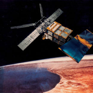
The ERS satellites shown the possibillities. Credit. EADS Astrium
The users’ need for detailed satellite pictures all hours of the day, has forced the satellite data suppliers to rethink old ways of usage and think of new ways. Optical sensors can only see the Earth’s surface parts of a day, the remaining time the surface is hidden by darkness during the nights or bad weather, such as clouds. However, the users of satellite data often need data 24/7 and the data suppliers need to think of implementing and using other types of sensors. The answer is to use radar sensors, as these sensors can penetrate both clouds and darkness.
Radar satellites have been used for decades, but data from these satellites most often belong to various governmental or military institutions, thus, it may take several days before a commercial user gets access to the data.
Europe has had radar satellites in orbit since the ERS-1 satellite was launched in 1992 and has recently launched the second satellite in the new generation of such sensors through the Sentinel-1 satellites, but data from these satellites have until recently essentially been used primarily for research and the delivery time can be days. This is not consistent with the commercial users’ need for quick response, thus, commercial satellite systems seem to be the answer.
The commercial market is huge and many suppliers are almost ready to enter the marked to deliver detailed radar pictures. Governmental users, like Copernicus, is mostly interested in the large view, whereas the commercial users need very detailed pictures.
Many Ideas at the Drawing Table – the Finnish Iceye Is One
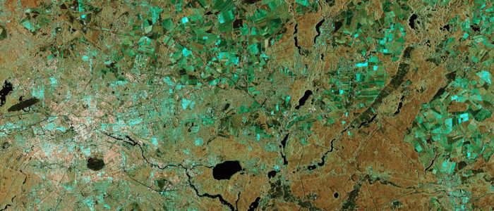
Sentinel 1A test image relayed to Earth by EDRS-A.
Credit: CopernicusSentinel data. Processed by ESA.
The suppliers have taken note of the growing demand for radar data and several systems are in the planning phase. The areas near the Arctic are parts of the world with cloudy weather as well as darkness during long periods of the year. Therefore, radar sensors are a must for the commercial companies that operate in the near arctic areas, on land or at sea.
The Finnish Iceye is planned to be a radar satellite system dedicated for the arctic area and based on several small satellites.
The project was initiated after a joint Technology Venture Course with the Stanford and Aalto universities. With a background in space and radio technology, the team quickly found a need for the services and products enabled by small satellite technology in the field of arctic operations. The market has also shown a great interest in the technology and the product by entering into development agreements. Iceye, plans to launch their first SAR micro satellites in 2017 and further down the road, create a swarm of 6-8 satellites to take images all around the world, but with especial focus on the arctic areas.
Traditionally, the space technology has been the arena of billion-euro research projects running over very long time-periods, from idea to results. Launch of small dedicated satellites will radically change both the project time and cost, and is possibly the new way for satellite projects.
From Course Project to International Scale
ICEYE was founded as a course project at Aalto University in 2012, and in 2013–2014, the team developed a prototype of the technology. The spin-off company started its operations in 2015 and today 15 people work for the company and new experts are sought from all over the world. Until recently, the funding mostly comes from Finnish governmental sources, but the company also received significant funding for the product from the space technology programme of the Horizon 2020 framework programme of the European Commission. Currently, the technology and service have been demonstrated by taking images from an airplane. The next step will be to build and launch a satellite which allows expanding the information service to cover the entire earth. The first launch is planned to take place in 2017.
Different Types of Systems
Iceye is not the only program for commercial use of radar satellites, nor the first. The main problem until now has been the level of details and the delivery time. Now, that can be changed. The market for radar satellites is expected to grow with over ten percent a year the next few years, much more than for the optical satellites, but the level today is much lower for radar based Products.
During the last few months, four companies have announced plans to build radar satellites for commercial use. The main reason is that the customers are now willing to pay for this service. In a new article from Space News, several projects are pointed out to be in the planning phase for launching in the next few years.
Radarsat Constellation Mission will possibly be launched in 2018. This is a Canadian governmental system, mainly with the aim to improve the Canadian needs. UrtheCast, based in Montreal, Canada, already has two cameras on the Space Station, however, plans are in place to build a constellation of eight satellites, four in sun synchronous orbits and four in medium inclination orbits, all ready for launch around 2020-21. The New York based Ursa Space plans to launch the first radar based satellites within “a couple of years” and XpressSAR, based in Virginia, plans to operate a four-satellite constellation
Did You Know
Synthetic aperture radar (SAR) is a form of radar which is used to create images of objects, such as landscapes – these images can be either two or three dimensional representations of the object. SAR is typically mounted on a moving platform such as an aircraft or spacecraft, and has its origins in an advanced form of side-looking airborne radar (SLAR). To create a SAR image, successive pulses of radio waves are transmitted to “illuminate” a target scene, and the echo of each pulse is received and recorded. The pulses are transmitted and the echoes received using a single beam-forming antenna, with wavelengths of a meter down to several millimetres. Current (2010) airborne systems provide resolutions of about 10 cm, ultra-wideband systems provide resolutions of a few millimetres, and experimental terahertz SAR has provided sub-millimetres resolution in the laboratory.
From Wikipedia.
Featured Picture.
Berlin from Sentinel 1A. Credit: Copernicus Data/ESA