
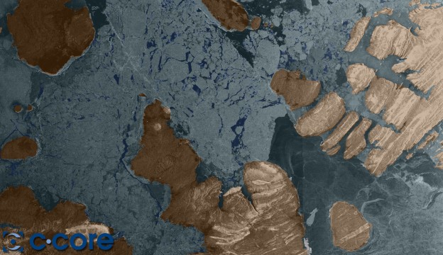
False-colour Envisat image from February 2007 of the Lougheed Basin in the Canadian Arctic Archipelago showing different types of ice. Credit: ESA/C-CORE
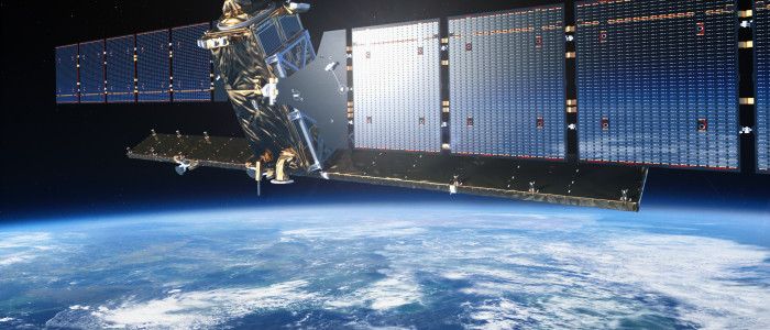
Since the early nineties, constantly monitoring our surroundings during day and night-time, in all types of weather conditions, has been a top priority within the research community from the early nineties. Now, the technique is well-proven and ready for operational use. With the launch of the Sentinel-1 satellite, the European Copernicus programme plans to get the first operational satellite in space, and nearly inevitably, the satellite must continue the measurement obtained by the forerunners; ERS and Envisat. With a new Synthetic Aperture Radar (SAR) operative in space the society will be able to make use of a nearly unbroken series of measurements from the early nineties, and with Sentinel 1B and 1C operative from later in this decade, the data stream will be unbroken until the middle of the next decade. The Sentinel-1 mission is a polar-orbiting satellite system with Synthetic Aperture Radar (SAR) as the main sensor.
Radar based sensors in space area very useful for Europe because much of the continent and surrounding oceans very often are covered by clouds and the northern parts are also in nearly continuous darkness in the winter season. An instrument that can monitor the Earth under these conditions has therefore been a top priority. For the Nordic countries, the new satellite is long overdue. . Raw data from radar satellites has been missing since Envisat stopped working two years ago. In the meantime, the Canadian Radarsat has delivered parts of the data the society sought after, but not enough. The mission will benefit numerous services. For example, services that relate to the monitoring of Arctic sea-ice extent, routine sea-ice mapping, surveillance of the marine environment, including oil-spill monitoring and ship detection for maritime security, monitoring land-surface for motion risks, mapping for forest, water and soil management and mapping to support humanitarian aid and crisis situations. Norway is deeply involved in the project. Mainly with managing of the receiving station at Svalbard, but also with delivering of hardware for the satellite, and not least, delivering of hardware for the ground segment.
Copernicus – the Main User
Copernicus, or Global Monitoring for Environment and Security (GMES) is the European initiative for setting up a wide capability for Earth observation. The programme consist of a space and ground segments. First proposed in 1998 the project has passed many milestones, but possibly the most important in 2007 when GMES was adopted by the European Union as the flagship next to Galileo. Since that, the project has been ongoing and with the launch of the first three Sentinel satellites this year the programmes will be operational from 2014, although the last sensors will be launched on the next generation of meteorological satellites later this decade. Denmark, Sweden and Finland are full members of the Copernicus due to their EU membership. Norway is in the process of deciding whether to enter the programme or not. However, through the membership in ESA, Norway will have access to data streams from the satellite through ESA’s “Full and open access to the Sentinel data” The Sentinel-1 mission is a polar-orbiting satellite system for the continuation of Synthetic Aperture Radar (SAR) operational applications. Sentinel-1 is a C-band imaging radar mission to provide an all-weather day-and-night supply of imagery for Copernicus user services. The first Sentinel-1 satellite will be ready for launch in spring 2014 and will be followed by the second satellite a few years later.
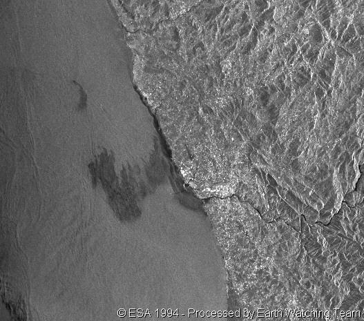
Oil slick detection by radar satellit. Oil slick along the coast of Oporto Portucal. Credit: ESA
Dedicated to Copernicus, Sentinel-1 will ensure the continuity of C-band SAR data, building on ESA’s and Canada’s heritage SAR systems on ERS-1, ERS-2, Envisat and Radarsat. The SAR sensor will operate in two main modes: Interferometric Wide Swath and Wave. The first has a swath width of 250 km and a ground resolution of 5×20 m. These two modes will satisfy most of the envisaged service requirements. Two other mutually exclusive modes are provided for continuity with other SAR missions and to accommodate emerging user requirements. Sentinel-1’s revisit time, geographical coverage and rapid data dissemination are key to providing essential data for Copernicus. The Sentinel-1 pair is expected to provide coverage over Europe, Canada and main shipping routes in 1–3 days, regardless of weather conditions. Radar data will be delivered within an hour of acquisition – a big improvement over existing SAR systems.