
Shipping has almost always been a key factor in terms of being able to sell and buy goods, so all types of trade have depended heavily on shipping opportunities, firstly on a local basis, gradually for markets father away, and eventually globalisation has proved dependent on shipping access internationally. Navigation across oceans was firstly based on knowledge from locals who mainly based it on their knowledge about the sun and the stars. Weather prognoses were based on knowledge, general experience and weather signs. Communication from the ship at open seas was impossible, but manual techniques were developed for communication between ships using eye contact.
Gradually, technical solutions were further developed, and today, technical advancements have replaced human activity many respects, however, despite all the advanced technological advancements, they cannot replace the experiences of humans, nor the capability to make the right decisions.
Satellites have played a key role for the shipping community for a long time, a role that became much more prominent with the introduction of autonomous and even unmanned shipping.
What can Satellites Contribute With?
There are three main areas showing their capability, and that is within meteorology, navigation and communication. In addition to these outstanding main areas, one has to mention the ships themselves, with more advanced and effective designs, more economically based engines and the right seaways.
Meteorology

Today, meteorological satellites are the main basis for most weather prognoses. With the introduction of the first satellites in the sixties it became possible to forecast the weather from an outside position, providing the meteorologists with a much more accurate weather forecasting. Since the first and relatively simple satellites, more advanced ones have been launched, as well as more advanced types of meteorological sensors. Together with the most powerful computers that exist, meteorologists have the best instruments in order to provide the shipping industry with reliable and detailed forecasts.
Most meteorological institutes are governmental, however, several commercially driven weather agencies spread around the world exist. One of these is the Norwegian StormGeo, established by some weather enthusiasts in the late nineties, and today, the institute is an important supplier of meteorological data and other services for the shipping industry.
The company offers traditional forecasts, services such as weather routing, voyage planning and route optimization, considering analysis of natural variables such as weather, wind and ocean currents in addition to data about the vessel. Through this information, the company can propose the most effective, the safest and most fuel-efficient routes. Playing together with the forces of nature the most effective route is found, however, it relies wholly on reliable forecasts, and that is where the satellites come into play.
Navigation
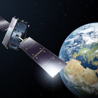 The Global Navigation Satellite System (GNSS) is today the closest to an absolute navigation system. Based on satellites in medium high orbits they can deliver position data all time and nearly all over the world. The system is a combination of data from the American NAVSTAR GPS, the Russian GLONASS, the European Galileo and China’s BeiDou, indeed a very international system.
This performance of the satellite data can be further improved by regional satellite-based augmentation systems, such as the European Geostationary Navigation Overlay Service (EGNOS). EGNOS improves the accuracy and reliability of GNSS information by correcting signal measurement errors and by providing information about the integrity of its signals.
Global Navigation Satellite System (GNSS) refers to a constellation of satellites providing signals from space that transmit positioning and timing data to GNSS receivers. The receivers then use this data to determine location.
Communication
 Lack of communication with the rest of the world was a large drawback before radio communication was established, but through the first halves of this millennium the radio communication was in steady development. Based on transmitters along the coasts most of the ships get access to communication with land, and between vessels at the oceans.
The introduction of satellite communication provided the shipowners and the seafarers with a whole new avenue of communicating, making the workday easier. Today they can communicate with the rest of the world all the time. The quality is constantly improving, and high-speed broadband is today accessible for large parts of the world, with the exception of the polar areas with relatively unstable communication systems, but it will improve.
To better the communication at the high latitudes Norway plans to establish a satellite based broadband service for the arctic areas. The service will be based on two communication satellites in highly elliptically orbits. Two satellites will be launched late in 2022, offering complete broadband service for the whole area north of the Polar Circle from 2023 and at least fifteen years ahead.
Monitoring the Shipping Industry
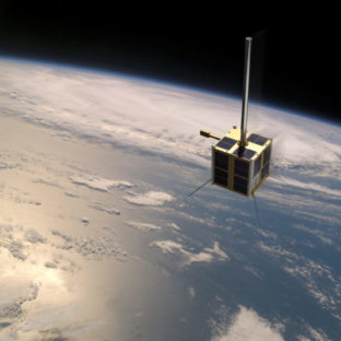
The Norwegian AISSAT monitoring the wessel trafic, mainly in the Northern areas.
Image: Norwegian Space Centre.
Traffic routing is necessary several places on the oceans due to the traffic of different types of ship is so large. Near the harbours dedicated traffic management centrals are establishes, and to avoid collisions, ships over a certain tonnage has the system Automatic Identification System (AIS) onboard. The system is equipped to avoid collisions; however, it is also a very useful tool to monitor the vessel traffic from space.
Today, Norway operates four micro satellites designed for monitoring ship traffic, mainly for detecting ships in nearby oceans, but they are also useful for detecting ships all over the world. All these satellites are based on registration of the ships’ AIS signals. However, some of the ships switch off the transmitter for several reasons, and the position cannot be detected.
The next satellite in the Norwegian monitoring system, NorSat-3, mainly a technology demonstrator, will have a navigational radar detector onboard in addition to the AIS detector. This will likely increase the capability to monitor all the sea traffic much more.
The future – Autonomous Shipping
The shipping industry is one of the key factors in international trade, however, also one of the worst polluters. To develop a more environmentally friendly transport, thus, has a high priority for the shipping community. The focus is toward more environmentally friendly fuels and engines, but there are a series of other factors that can make the shipping “greener.
Effective shipping already starts at the mill or at the factory and does not stop until the gods are at the user’s plant. The goods can be raw materials like oil and ore, semi-raw materials like steel and timber or products like clothes, electronics and cars. Common for all this transport is the demand for quick delivery and low transport costs.
One of the possibilities is the use of autonomous ships. Transport between e.g. Asia and Europe takes several weeks and personnel and fuel costs are considerable costs. To reduce the personnel costs, the speed can increase, but it brings about higher fuel costs. Decreasing speed reduces the fuel costs but increases the personnel costs. The solution can be autonomous shipping with few or no crew onboard, as well as slow speed.
The technical systems are now accessible, and the development of autonomous system has a high priority in the shipping community.
Norway has always led the way when it comes to maritime activity, a position they wish to retain, including a desire to further developing and using the most advanced techniques for an effective and environment friendly shipping industry.
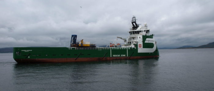
Featured picture: NordicSpace