
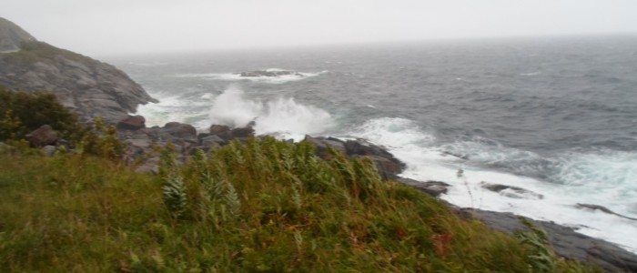
The combination of low air pressure, full moon and strong wind gave in January and February very high tide along the Norwegian coast. Some areas had a tide around one metre over the normal high tide. Luckily the storms been weaker than the warn and the damages been not so comprehensive as feared. But the high flood tide gave a warning about the higher and ascending sea level can lead to.
The Scandinavian peninsula and other north areas were during the glacial epoch under very high ice cap. This cap holds the land down and in spite of thousands of years since, the land is still rising. This fact will not give the same ocean change as at some other parts of the world. In spite of this advantage the sea level along the coasts will increase between 200 to 800 millimetres in this millennium, depend of how large the air temperature rising will be, 1.5 degree, 2.0 degree or, in the worst case – more and the 2.0 degree.
Why rise the sea level? Mainly of two reasons – higher temperature of water gives increasing volume of existing water, while melting of the large glaciers give more water to the oceans.
A very large part of the world’s population live in areas as will be affected of the higher ocean level and the consequences will be large relocations and migration.
How detect possible increasing ocean level?
One of the consequences of higher global temperatures are, as mentioned, increasing of sea level. It is so small as few millimetres per decade but the basically sea high and the increasing are not similar the globe over. How can the scientist detect the increasing high world over? The answer is – the satellites.
Since 1992 dedicated satellites has monitored the ocean’s level, and through the nearly three decades of monitoring the trend, the conclusion seems clear – the oceans high increases in increasing rate.
The first satellite in this series was the French/American Topex/Poseidon. The satellite, launched in 1992, orbited Earth at a high of 1340 km, with an inclination of 66 degrees. That will say that the satellite monitored all oceans between the Earth’s Polar Circles. The satellite’s measurements of hills and valleys of the sea surface led to a fundamental new understanding of ocean circulation and its effect on the climate.
Topex/Poseidon was a success and the successors, Jason 1 to 3 been launched through the first decades of this millennium, still a cooperation project between France and USA. However, the success with monitoring the ocean from satellites lead new partners to the cooperation. The European meteorological organisation EUMETSAT and the European Union been partners in the missions.
The next satellite in the series, Jason CS (Continuity of Service)/Sentinel 6, will be a cooperation between Europe and USA. Satellites launched in 2020 and 2026 will give continuous data from 2020 to several years in the fourth decade of this millennium.
Sentinel 6A is now renamed after the Earth scientist Dr Michael H. Freilich and the two satellites will be named Sentinel-6A Michael Freilich and Sentinel-6B.
Did you know.
An altimeter measures how high something is. Satellite radar altimeters measure the ocean surface height (sea level) by measuring the time it takes a radar pulse to make a round-trip from the satellite to the sea surface and back. Bathymetry is measurement of the depth of the ocean. NOAA, among other, does research to see how they can estimate bathymetry from space radar measurements of sea level.
Seventy percent of Earth’s surface topography is under the oceans and cannot be directly sensed by lasers or radars. Direct measurement of ocean depths is done by echo sounders carried by ships, but only a few percent of the ocean has been mapped at this way.
NOOA use satellite radar altimeter measurements of the ocean surface height (sea level) to infer the presence of mountains below. Mountains on the sea floor add extra pull to Earth’s gravity field, drawing more water around them and bulging the sea surface outward. This way of estimating depth been called “altimetric bathymetry”.
An undersea mountain has to be about more than a kilometre high and several kilometres wide in order to generate enough of a bump in sea level to be recognizable in current radar altimeter data. Therefore, altimetric bathymetry is not as accurate or detailed as echo sounding from ships. Even so, because altimeter satellites cover the whole Earth while ships have mapped only a few percent, the best global bathymetric models combine conventional echo soundings with altimetric bathymetry. The research led to a bathymetric model that has been widely used in the scientific community for more than a decade.
Source: NOAA and Wikipedia.