
More Challenging Than the South and Covers Both Weather and Ice
Few countries have such a large span in their forecasting as Denmark. The mainland is localised around 55 degrees north, but the forecasting also includes Greenland with large oceans and land areas mainly north of the Arctic Circle. Many people along the coast of Greenland live in the border of habitable areas. Reliable forecasting is actually more necessary here than in the temperate zones. How can the Danish Meteorological Institute (DMI) provide this service?
Unlike most of the world, the forecasting for Greenland will consist of both weather and ice forecasting.
The weather forecasting is traditional, as it is based on satellite data, data from meteorological observation stations and accessible models, the weather conditions are estimated. However, there are numerous types of challenges. The geostationary satellites provide bad coverage at such high latitudes, the number of weather stations is limited and at the icecap nearly without observation points. In addition, especially wind conditions, the so – called Piteraq, complicate the forecasting.
To provide the Danish meteorologists with the best basis for assessment, they must spend at least six months as airplane meteorologists at the main airport at Greenland, Kangerlussuaq (Søndre Strømfjord). The aim is to give
Unlike most of the world, the forecasting for Greenland will consist of both weather and ice forecasting.
The weather forecasting is traditional, as it is based on satellite data, data from meteorological observation stations and accessible models, the weather conditions are estimated. However, there are numerous types of challenges. The geostationary satellites provide bad coverage at such high latitudes, the number of weather stations is limited and at the icecap nearly without observation points. In addition, especially wind conditions, the so – called Piteraq, complicate the forecasting.
To provide the Danish meteorologists with the best basis for assessment, they must spend at least six months as airplane meteorologists at the main airport at Greenland, Kangerlussuaq (Søndre Strømfjord). The aim is to give the people on Greenland the same services as on the mainland.
Covers Both Weather and Ice
Few countries have such a large span in their forecasting as Denmark. The mainland is localised around 55 degrees north, but the forecasting also includes Greenland with large oceans and land areas mainly north of the Arctic Circle. Many people along the coast of Greenland live in the border of habitable areas. Reliable forecasting is actually more necessary here than in the temperate zones. How can the Danish Meteorological Institute provide this service?
Unlike most of the world, the forecasting for Greenland will consist of both weather and ice forecasting.
The weather forecasting is traditional, as it is based on satellite data, data from meteorological observation stations and accessible models, the weather conditions are estimated. However, there are numerous types of challenges. The geostationary satellites provide bad coverage at such high latitudes, the number of weather stations is limited and at the icecap nearly without observation points. In addition, especially wind conditions, the so – called Piteraq, complicate the forecasting.
To provide the Danish meteorologists with the best basis for assessment, they must spend at least six months as airplane meteorologists at the main airport at Greenland, Kangerlussuaq (Søndre Strømfjord). The aim is to give the people on Greenland the same services as on the mainland.
Challenging Near Arctic Conditions
The air over Greenland is dry, cold, and often very stable. A whole month without precipitation is not an exceptional occurrence, but in spite of the dry conditions, extreme precipitations can also occur.
The normal temperature is over the zero point only six months of the year, while the lowest temperatures, night temperature, is over the zero only three months outside the ice cap. However, temperatures up to fifteen degree plus in winter months have also been measured.
The warmest day since 1958, where official measurements began, was 25,9 degree C at the southwest coast of the island. That was a one-time occurrence, but the trend is also increasing temperatures.
The coldest day is from January 1989 with -52, 1 degree C, while at the icecap temperatures down to – 63 degrees have been measured.
The wind can also be strong. During the “Large Piteraq in February 1970 the max gust of wind was estimated to 90 m/sec (324 km/t). Estimated, because the anemometer collapsed with 72 m/sec (260 km/t). Maximal stable wind is measured to 54 m/sec (194 km/t).
The summer is light over the island, but the winter can be challenging, with low temperatures combined with polar nights.
Ice Mapping and Ice Warning
 The ice complicates the services for the people in Greenland considerably. The fairways around Greenland is never free of drifting ice. Detecting the ice situation and providing a general view of the fairways is therefore an important part of DM’s service for the society.
Ice maps are constantly worked out for the areas that are accessible for shipping traffic. The area will vary with the seasons. In the cold part of the year, much of the surrounding areas is completely covered by thick ice and therefore not accessible for ships. In the warm season the open areas can go higher than 75 degrees north at the west coast. The eastern areas are covered in drifting ice most of the year. The ice in the west is mainly one – year – old ice of a thickness of one metre, together with icebergs from calving glaciers. In the east, the ice is several years old ice from the pole areas of a thickness of several metres.
 The Ice Service at Centre for Ocean and Ice can work out ice maps for areas around the whole island, mainly for the shipping industry, for some areas weekly, for other areas frequently or at orders. The southern part is mapped several times a week on an annual basis.
Data for ice mapping is mainly received from the Canadian Radarsat. The solution is about 100 metres but can be increased to near 10 metres for small areas. Since the Sentinel 1 satellite became operational, the solution became considerably better. In the light and cloud free time of the year, optical sensors can be used and provide a better solution.
The ice thickness is not a part of the ice service, and the forecasts only indicate the ice coverage. One estimates that a coverage of about 10-20% means that the ocean is nearly free, but with 70-80 %, the ocean is nearly completely covered and difficult to pass through.
Regular ice monitoring started in 1959. Since then, the differences in ice coverage have varied greatly over the years. However, the long-time trend is that the ice formations starts later now than due to a regular ice detection, but the time when the one- year ice bracing up is nearly the same.
Ice – the Year Around.
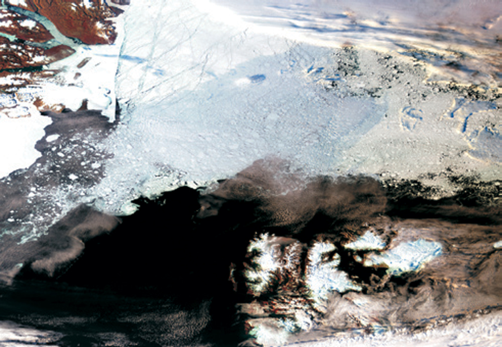
The cold climate and lack of warm ocean currents result in that Greenland is as “dumping ground” for much of the earth’s ice, not only the ice cap and the large glaciers, but also much of the sea ice and drifting ice are found along the Greenland coast. This obviously is challenging for the sea traffic and for any supplies of resources to far communities along the coasts of the island.
In the winter, most of the coasts of Greenland are covered in ice and the northern areas are accessible only few months of the year. The sea ice west of Greenland is called the West Ice, and most of the Baffin Bay is nearly completely covered in ice in the wintertime, but open in the late summer months. Ship traffic along the coast to Qaanaaq (Thule) at 77 degrees north is mostly possible from July to September, while Aasiaat (Egedesminde) and Ilulissat (Jakobshavn) at 65-70 degrees normally are open for shipping between May and December.
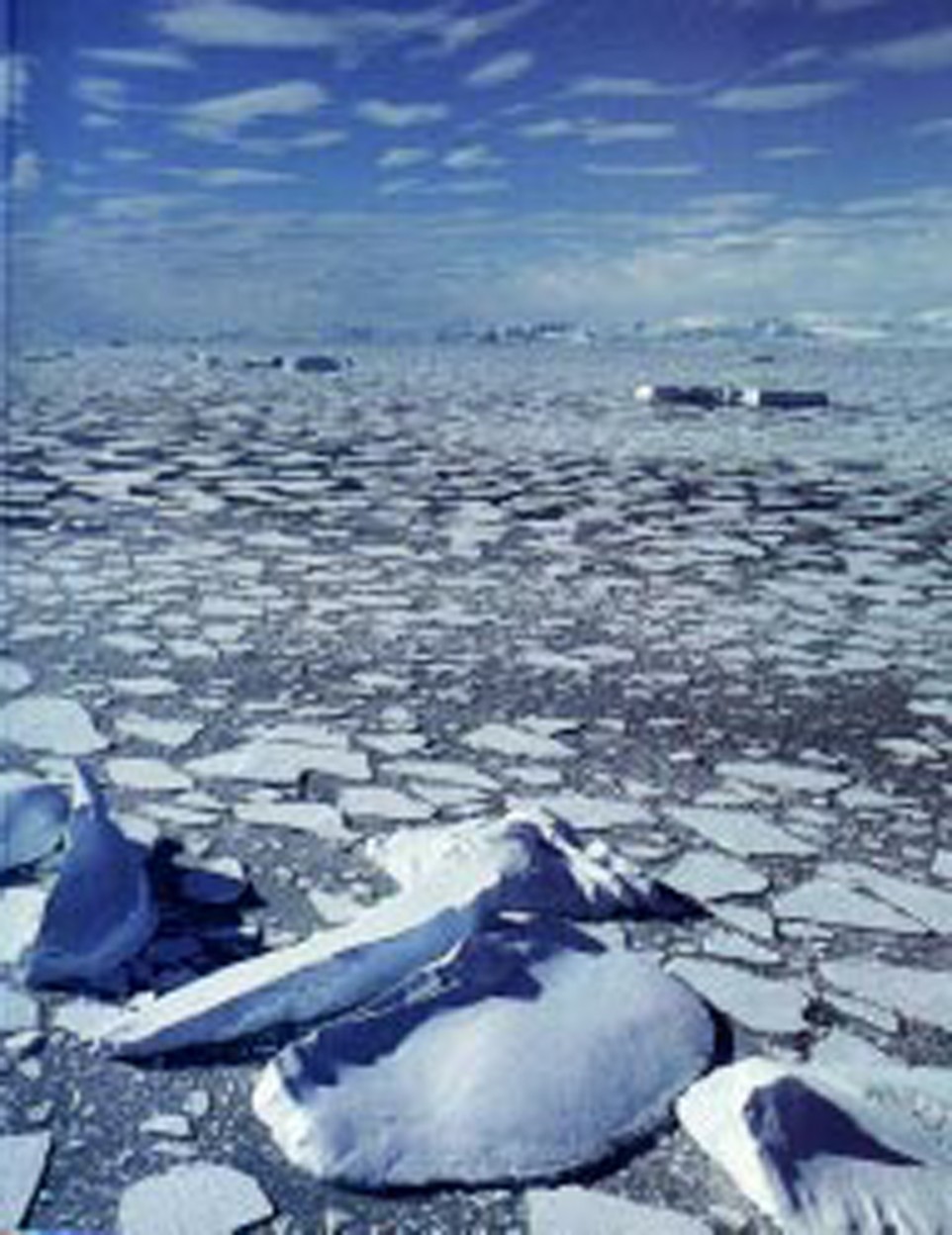
The sea ice on the east coast is a several- hundred- kilometres belt of drifting ice in constant movement from north toward south.
In the east the ice conditions are somewhat different and more dynamic than the West Ice. Most of the year the sea is covered in drifting ice from the Polar Basin, in the wintertime in combination with one – year sea ice. Every second 150 000-m3 ice stream through the Fram Strait between Greenland and Svalbard.
North of Illoqqortoormiut (Scoresbysund) at 70 degrees north more than 80% of the sea is covered in ice nearly the whole year. South of Illoqqortoormiut there is large seasonal variation in the coverage due to melting and spreading. The broad ice belt is challenging for the sea transport the whole year and ice monitoring, mapping and forecasting are quite necessary.
The ice complicates the services for the people in Greenland considerably. The fairways around Greenland is never free of drifting ice. Detecting the ice situation and providing a general view of the fairways is therefore an important part of DM’s service for the society.
Ice maps are constantly worked out for the areas that are accessible for shipping traffic. The area will vary with the seasons. In the cold part of the year, much of the surrounding areas is completely covered by thick ice and therefore not accessible for ships. In the warm season the open areas can go higher than 75 degrees north at the west coast. The eastern areas are covered in drifting ice most of the year. The ice in the west is mainly one – year – old ice of a thickness of one metre, together with icebergs from calving glaciers. In the east, the ice is several years old ice from the pole areas of a thickness of several metres.
The Ice Service at Centre for Ocean and Ice can work out ice maps for areas around the whole island, mainly for the shipping industry, for some areas weekly, for other areas frequently or at orders. The southern part is mapped several times a week on an annual basis.
Data for ice mapping is mainly received from the Canadian Radarsat. The solution is about 100 metres but can be increased to near 10 metres for small areas. Since the Sentinel 1 satellite became operational, the solution became considerably better. In the light and cloud free time of the year, optical sensors can be used and provide a better solution.
The ice thickness is not a part of the ice service, and the forecasts only indicate the ice coverage. One estimates that a coverage of about 10-20% means that the ocean is nearly free, but with 70-80 %, the ocean is nearly completely covered and difficult to pass through.
Regular ice monitoring started in 1959. Since then, the differences in ice coverage have varied greatly over the years. However, the long-time trend is that the ice formations starts later now than due to a regular ice detection, but the time when the one- year ice bracing up is nearly the same.
In the winter, most of the coasts of Greenland are covered in ice and the northern areas are accessible only few months of the year. The sea ice west of Greenland is called the West Ice, and most of the Baffin Bay is nearly completely covered in ice in the wintertime, but open in the late summer months. Ship traffic along the coast to Qaanaaq (Thule) at 77 degrees north is mostly possible from July to September, while Aasiaat (Egedesminde) and Ilulissat (Jakobshavn) at 65-70 degrees normally are open for shipping between May and December.
The sea ice on the east coast is a several- hundred- kilometres belt of drifting ice in constant movement from north toward south.
In the east the ice conditions are somewhat different and more dynamic than the West Ice. Most of the year the sea is covered in drifting ice from the Polar Basin, in the wintertime in combination with one – year sea ice. Every second 150 000-m3 ice stream through the Fram Strait between Greenland and Svalbard.
North of Illoqqortoormiut (Scoresbysund) at 70 degrees north more than 80% of the sea is covered in ice nearly the whole year. South of Illoqqortoormiut there is large seasonal variation in the coverage due to melting and spreading. The broad ice belt is challenging for the sea transport the whole year and ice monitoring, mapping and forecasting are quite necessary.
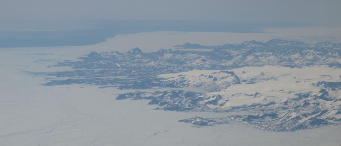
Featured image.
The coast of Greenland. Credit: NordicSpace.